Map every farm. Work offline.
VetMapping puts animal, dairy, poultry and fish farms on the map — with radius tools, visit notes and Excel import/export — for vets and livestock teams who work where the signal doesn't.
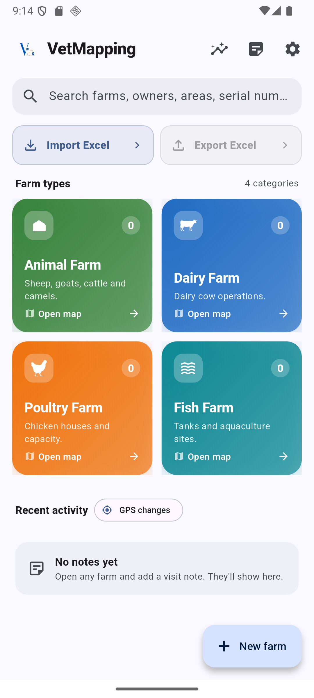
Everything you need on one map.
Designed for one-handed use in the sun, with no signal and no login. Your data stays on your device.
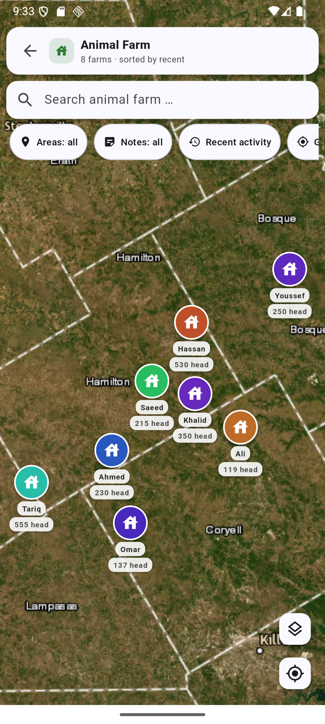
Map every farm
Animal, dairy, poultry and fish — color-coded markers show owner and livestock count at a glance.
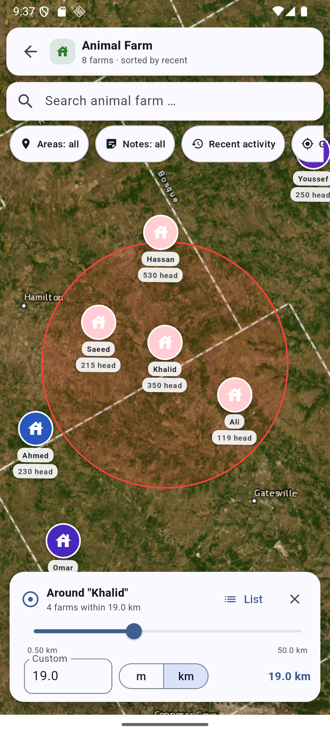
Radius tool
Draw any radius in km or miles. Instantly see — and export — every farm within reach.
Smart search
Find a farm by name, serial or address. Results jump straight to the pin on the map.
Excel import
Bring hundreds of farms in from a spreadsheet. Map your columns once, reuse the layout.
Excel export
Reorder columns, drop what you don't need, share to email, Drive or chat in two taps.
GPS corrections
Long-press to drop a pin and move a farm — every change is logged with a full audit trail.
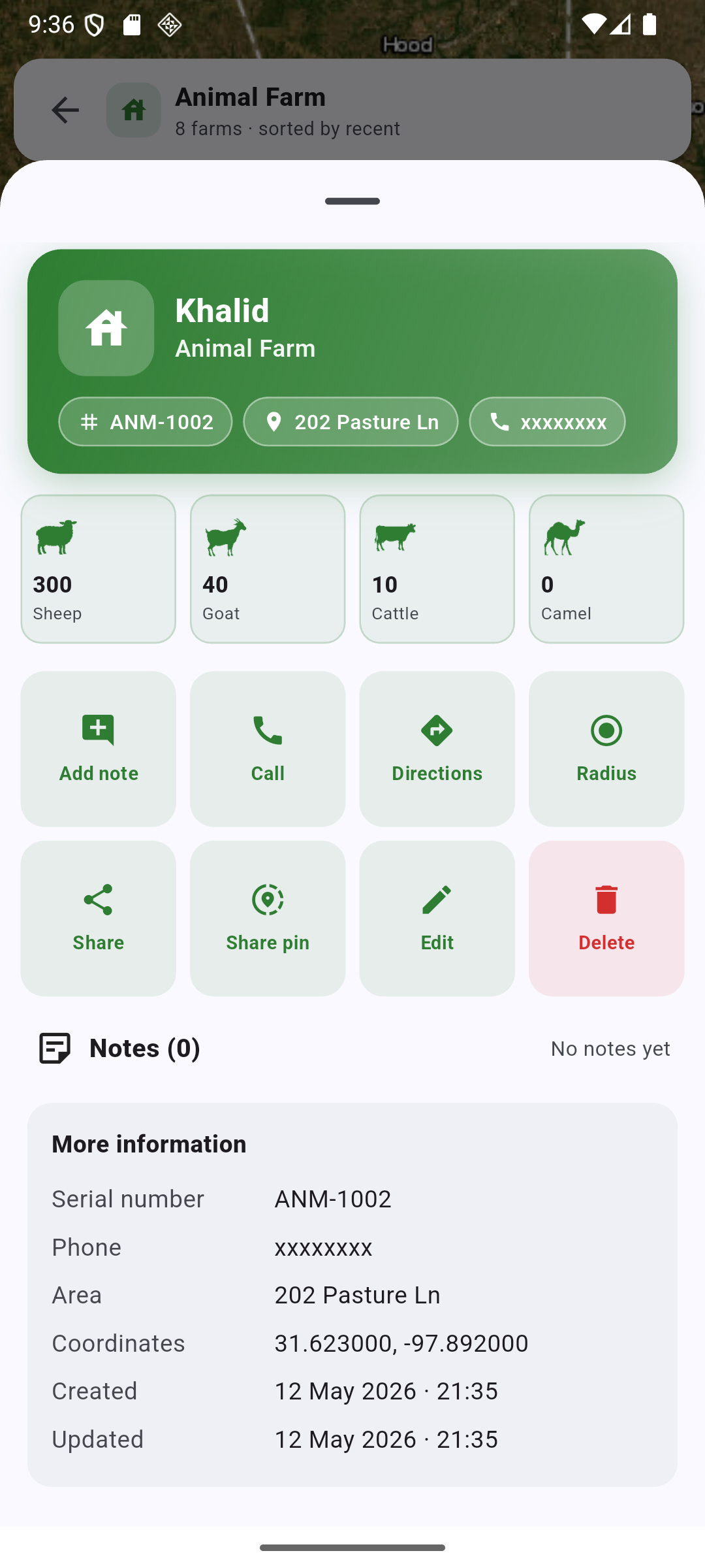
Visit notes & photos
Capture findings in the field. Critical notes highlight the farm on the map.
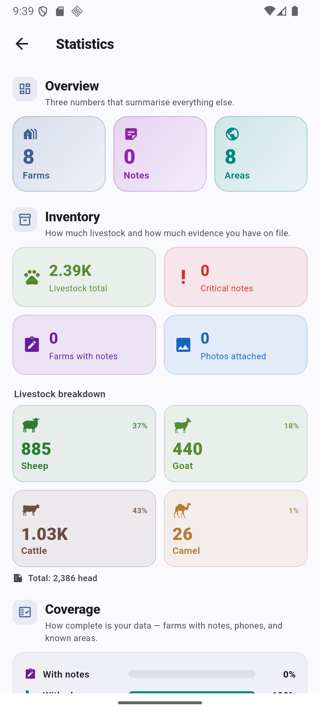
Statistics
Livestock totals, coverage, notes and photo evidence — summarised across your operation.
100% offline
No login. No analytics. Your data lives on your device until you choose to share it.
See it in action.
Real screens from VetMapping — dashboard, map, radius and audit trail.
Ready to map every farm?
Download VetMapping on the App Store and Google Play. Free to install — your data stays yours.
Get VetMapping